MS-DOS applications: PC Globe 5
We already explored many topics such as curious graphical editors, various file managers creating a genre reaching well into Windows era, ingenious file compression and memory management tools, which in time gave way to whole disk compression techniques. Lately we got even more serious to talk about industrial design tools, TCP and web browsers, things that MS-DOS wasn’t even designed to use. We also made a quick pass by Borland Pascal, one of the few development tools available at the time used to create all that wealth of applications.
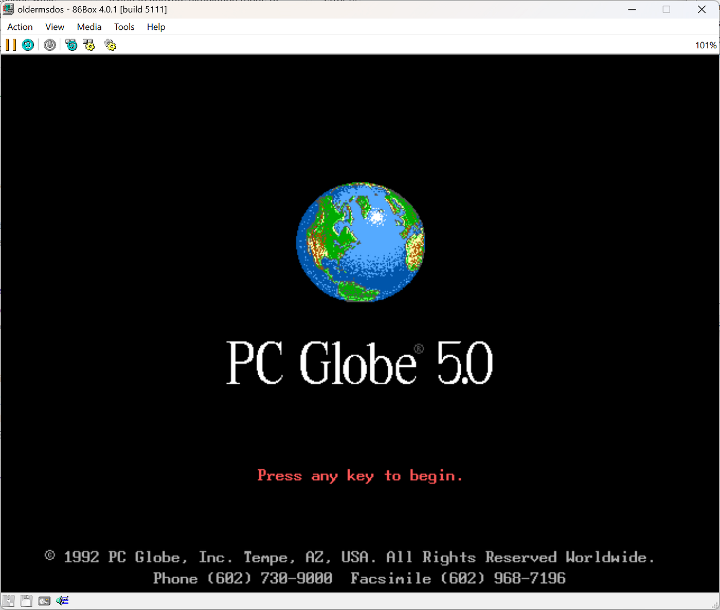
Today we will branch out yet again and talk about a software that was very dear to me for a while. We are going back yet again to the nineties. I cannot pinpoint the exact year I got this software, I am thinking very late nineties, but the software itself was first released in 1990, and this particular version in 1992: PC Globe 5. Now, for a bit of context, in the nineties the idea of a computer version of a world atlas or an encyclopedia was quite bold. PC Globe was one of the very first MS-DOS applications to explore this topic. And judging the amount of work, innovation and ingenuity required to pull it off: the developers absolutely nailed it. You can grab it from WinWorld or from my GitHub page.
PC Globe is so old it won’t even run on an Intel 80486 system. Due to a bug that never was discovered nor fixed back then, starting PC Globe on faster systems would crash with a runtime error:

The error is elusive enough, but it was a well-known stumbling block for the applications built in the day. It originated with the handling of floating-point errors, which on slower CPUs had an understood and corrected behavior. Faster CPUs unfortunately increased the probability of these errors up to certainty, making software crash with the above error. But if we decrease the processor class to an Intel 80386, PC Globe finds again the familiar setup needed to thrive:
So, what was it about?

As we said before, not much was happening in the world atlas space in the nineties. Besides PC Globe there was another atlas some of our US readers will surely remember, DeLorme Street Atlas. While PC Globe presented high level overviews of countries, the Street Atlas dealt with obscure and lesser-known trails and locations throughout the US. Unfortunately, I did promise to write only about software I used so I won’t insist on the Street Atlas, even though it has a beautiful story of its own that I only recently uncovered.
In time, DeLorme moved on as part of Garmin, and PC Globe simply faded out in obsolescence. The reason for obsolescence? Well, it’s Microsoft. And I will have something to write about this in the future. It was the boldest product in my opinion that they ever released back then which I also got to own: Microsoft Encarta with its spin, Microsoft Encarta World Atlas.
But before all of that was PC Globe, and we can see its main look in the screenshot above. And yes, it did open with the menu activated, probably to make it easier for users to understand their options. The options were many:
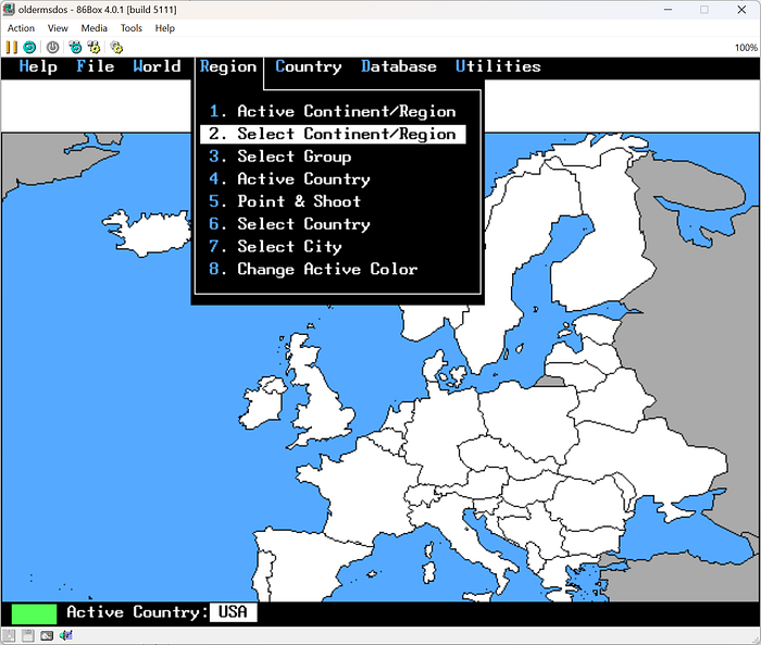
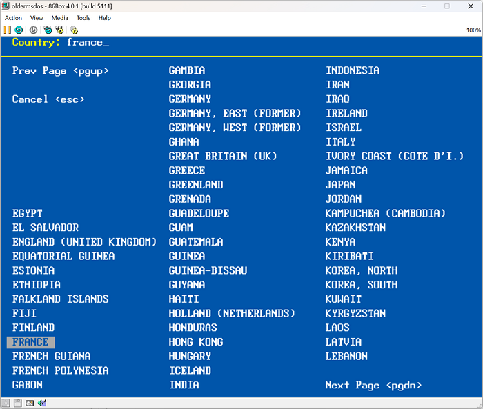
We could select and zoom in on regions and countries of course:
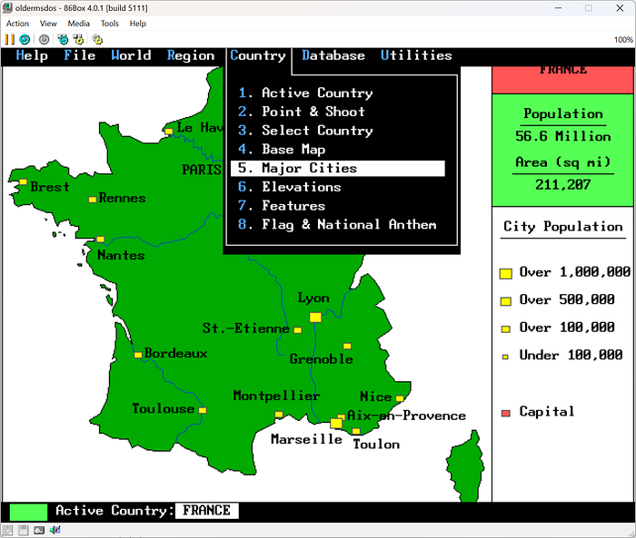
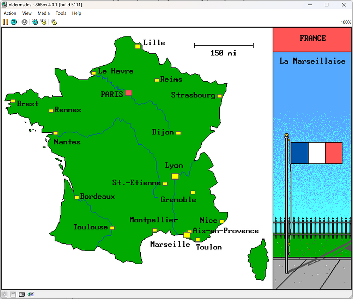
We could see the selected country's major cities:
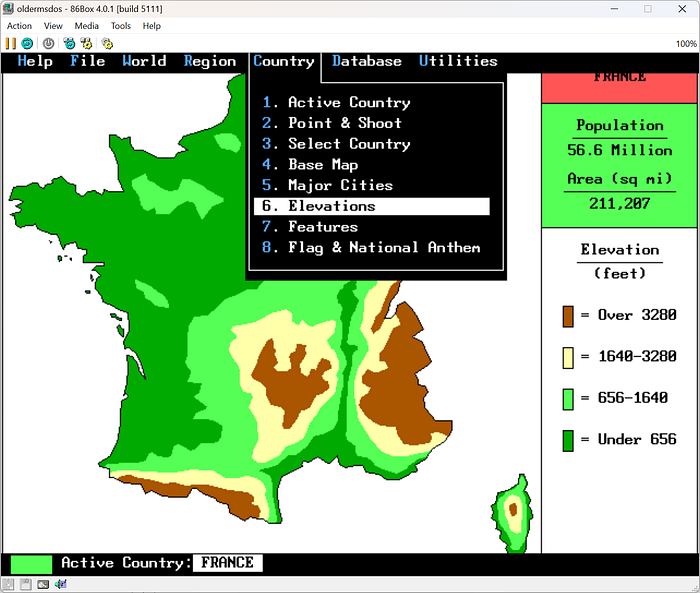
We could look at the selected country’s elevation map:
We could see the main features of the selected country:

And we could see the flag and listen to the national anthem:
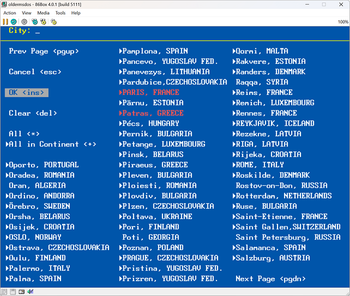
We could select multiple cities to see where they are on the map:
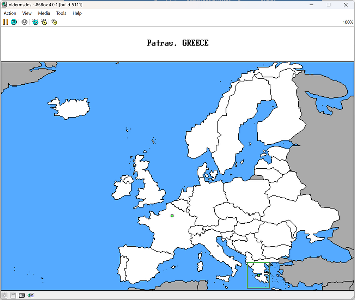
Pressing insert or choosing OK in the selection list above would take us to the map view with the cities highlighted:
But that’s not all
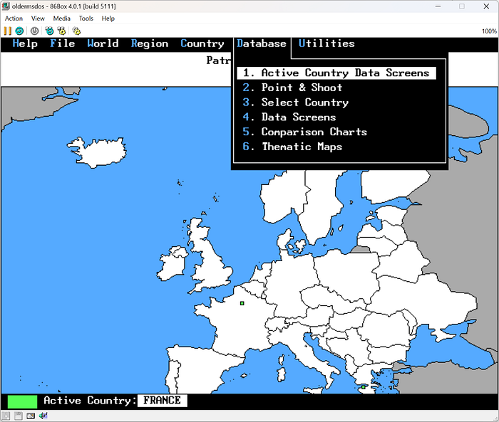
Those are all operations we can expect to conduct with a world atlas, and here we see they are all accessible with PC Globe. But there was one more menu entry which could really wow unexpecting users, the Database as seen in the screenshot above. We could select a country and see its atlas data:
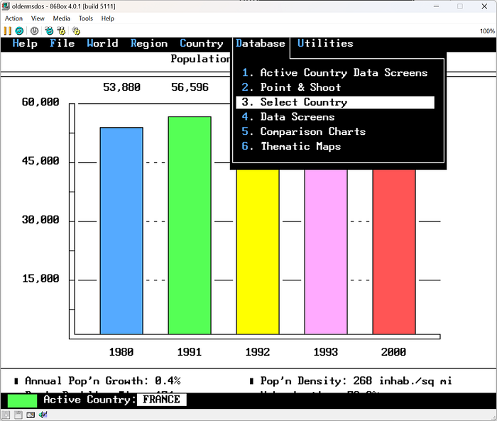
It had several data screens accessible by selecting a country and pressing enter or by selecting Data Screens in the Database menu and selecting what we want to see:
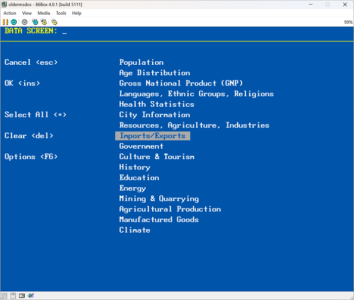
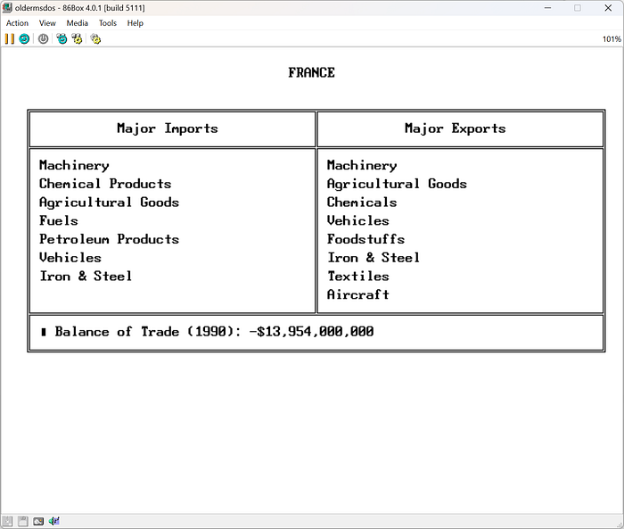
By selecting Imports/Exports we could see historical data about France:
And that’s not even all, we could also select Comparison Charts from the menu and get quick overview comparisons between countries:

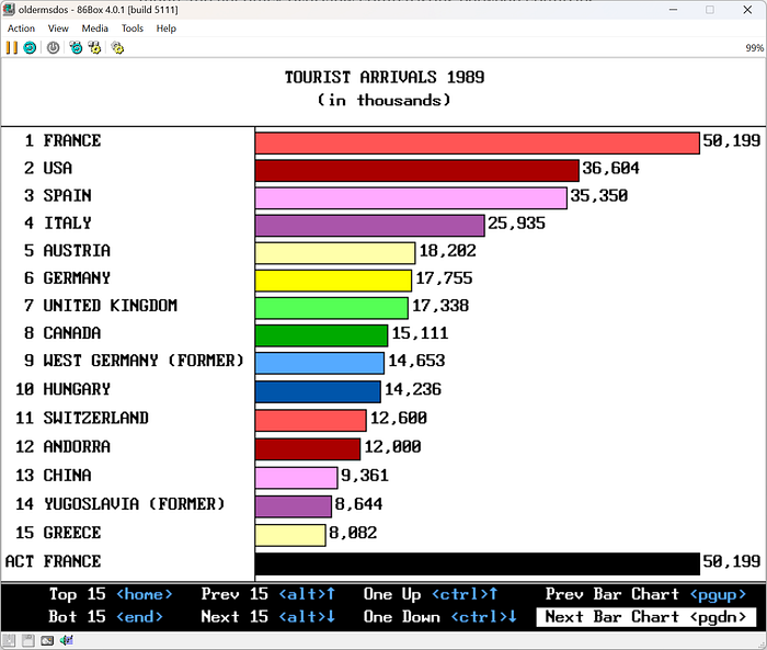
Here is another comparison chart for number of tourist arrivals in 1989:
And again, there is more under the Thematic Maps option in the Database menu:

We can choose to see urbanization percentages for the whole world on a map:
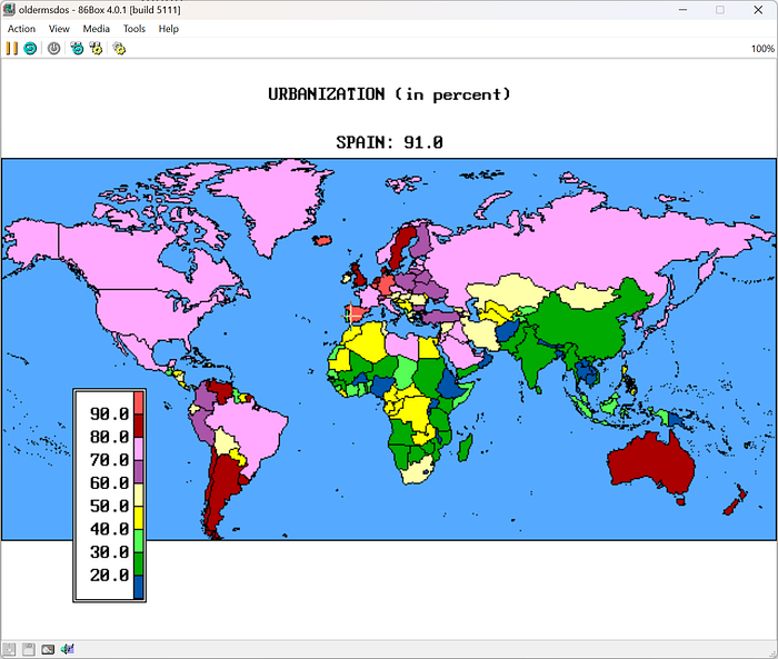
We can also select a country using the mouse or the keyboard and see its value as a subtitle above the map. And now that I mentioned the keyboard, I have to say just how easy and streamlined the keyboard control is for this application. Using very few keys, usually just the arrows and enter, we can browse a wealth of information in a graphical format in seconds.
The user interface is also very clear about what is important: the map. It takes the whole screen, and the menu hides away after each selection. If we need the menu back, we can get it by pressing any key and it will return to our previous selection, making it easy to move forward with different views about the same country. This is a well-designed application.
Also at first, I wanted to install my mouse driver to make it easier to work with a map, used to how map applications work today, but after forgetting about it and using the keyboard for a few minutes I found out the UI doesn’t need a mouse at all. It’s so quick and streamlined you don’t feel inadequate for using the keyboard on a data and selection intensive application with a graphic UI. This was of course by design, and I must applaud the designers here, even though they will most probably never know about it.
This was my first world atlas application. I used it dearly and welcomed all its country statistics, maps, and comparisons. Especially in a year when computers didn’t really act as encyclopedias. But as we said before, all this would soon change with Encarta. Thank you for being with me reading about this memory. See you next time!